
When a high-value asset vanishes from a staging yard, or a family vehicle fails to return home on time, the value of precise positioning shifts from an abstract convenience to a critical operational priority. Choosing the wrong equipment can lead to systemic failures: dead batteries when a vehicle needs recovery, dropped connections in challenging topography, or unexpected subscription costs that inflate long-term operating budgets.
The tracking market is filled with mislabeled consumer products, ambiguous network specs, and confusing recurring service models. Selecting the correct device requires looking past marketing promises to analyze the underlying hardware engineering, cellular network architecture, and processing firmware.
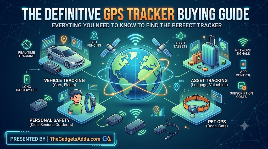
This guide systematically deconstructs real-time location hardware, helping you select a tracker matched to your specific operational constraints.
Defining the Modern GPS Tracker
An active GPS tracker is an integrated electronic system combining a Global Navigation Satellite System (GNSS) receiver, a cellular or satellite telemetry module, an internal micro-controller, and a dedicated power supply. Unlike passive loggers that store coordinate data to local flash memory for manual extraction, an active tracker calculates its spatial coordinates in real time and immediately transmits this telemetry to a remote cloud server.
+------------------+     +-------------------+     +--------------------+
|  GNSS Satellites | --> | GPS Tracker Unit  | --> | Cellular / Sat Net |
|  (GPS, Galileo)  |     | (Receiver+Modem)  |     | (LTE-M, NB-IoT)    |
+------------------+     +-------------------+     +--------------------+
                                                            |
                                                            v
+------------------+     +-------------------+     +--------------------+
| Mobile App /     | <-- | Cloud API Server  | <-- | Base Station /     |
| Desktop Browser  |     | (Data Processing) |     | Gateway Receiver   |
+------------------+     +-------------------+     +--------------------+
Why Asset Tracking Infrastructure Matters
Relying on physical visual checks or retrospective audits creates significant security blind spots. Active tracking transforms asset management from reactive recovery to proactive protection.
Asset Recovery and Risk Mitigation
For vehicle fleets, construction equipment, and high-value cargo, tracking hardware forms the backbone of loss-prevention systems. If theft occurs, real-time location data allows field teams to provide law enforcement with exact coordinates, reducing recovery times from weeks to hours and lowering insurance premiums.
Operational Transparency
In commercial logistics, knowing a vehicle’s precise location allows dispatchers to optimize routing, estimate arrival times accurately, and verify driver timesheets automatically. This oversight streamlines operations and provides clear accountability if disputes arise over delivery windows or unauthorized asset usage.
How Active Tracking Systems Work
Operating an active tracker involves a complex chain of data handoffs across three distinct technical layers.
1. Coordinate Acquisition (The GNSS Layer)
The tracker’s internal GNSS antenna continuously listens for microwave radio signals transmitted by satellite constellations orbiting the earth. To calculate a two-dimensional position (latitude and longitude), the onboard receiver must lock onto signals from at least three satellites simultaneously.
Locking onto a fourth satellite adds altitude data and establishes an accurate time offset. Modern commercial trackers use multi-GNSS receivers that pull signals from the United States GPS network alongside international systems like Europe’s Galileo, Russia’s GLONASS, and China’s BeiDou, ensuring consistent satellite visibility even in dense environments.
2. Telemetry Transmission (The Network Layer)
Once the internal processing chip computes the raw coordinates, it packs the latitude, longitude, velocity, timestamp, and hardware health metrics into a compressed data packet. The unit then activates its onboard cellular modem to transmit this packet over regional wireless infrastructure.
In the United States, modern trackers rely almost entirely on 4G LTE-M (Long Term Evolution for Machines) or NB-IoT (Narrowband Internet of Things) channels. These specialized cellular networks offer deeper building penetration and significantly lower power requirements than standard consumer smartphone bands.
3. Data Processing and Visualization (The Software Layer)
The cellular network routes the transmitted data packet across the internet to a cloud-hosted central API server. The server parses the raw hex strings, writes the telemetry records to an encrypted database, and cross-references the coordinates against user configurations like geofences or speed thresholds.
Finally, the processed data is pushed to user interfaces, letting operators monitor the asset via web browsers, desktop fleet software, or mobile applications.
Core System Benefits
- Automated Geofencing: Users can map virtual geographic boundaries over specific properties. The software instantly triggers push or SMS alerts the moment a tracker crosses these designated boundaries.
- Historical Route Playback: Cloud platforms maintain chronological breadcrumb trails, allowing managers to audit historical speed patterns, stop durations, and total mileage over months of operation.
- Sensor Integration: Many advanced tracking units capture more than just location, recording ambient temperature, ambient light changes, 3-axis accelerometer impacts, and vehicle engine diagnostics.
Real-World Limitations and Technical Challenges
Active tracking systems offer powerful capabilities, but they are bounded by clear technical constraints that operators must understand.
Signal Obstruction and Attenuation
GNSS signals operate on line-of-sight microwave frequencies that struggle to penetrate dense solid matter. When an asset enters a concrete parking garage, a subterranean tunnel, or a dense urban canyon surrounded by skyscrapers, the satellite signals experience multi-path interference or outright blockage.
While advanced cellular triangulation or Wi-Fi sniffing can provide fallback location estimates, true GPS accuracy drops significantly without clear sky visibility.
The Power-to-Ping Tradeoff
Every cellular transmission consumes considerable battery power. A tracker configured to report its position every ten seconds will deplete its power reserves much faster than a device set to check in once per day.
Engineers face a balance between high-frequency location updates and extended operational battery life. To help visualize this performance relationship, consider the basic mathematical framework used to estimate battery run-time:
$$\text{Battery Life (Hours)} = \frac{\text{Battery Capacity (mAh)}}{\left(\text{Active Current (mA)} \times D\right) + \left(\text{Sleep Current (mA)} \times (1 – D)\right)}$$
Where $D$ represents the operational duty cycle, calculated as the ratio of active transmission time relative to total deployment time. Minimizing this duty cycle through adaptive motion sensors is essential for extending battery performance on unpowered assets.
Subscription Overhead
Because trackers constantly stream data over commercial cellular networks, they require an active data plan. Buyers must account for ongoing monthly or annual subscription fees alongside the initial hardware costs. Selecting a tracker with an inflexible long-term contract can lead to high overhead costs if your deployment needs change.
Hardware Classifications
Selecting the right tracker form factor depends primarily on your asset’s power availability, mounting constraints, and how often you need updates.
Battery-Powered Portable Trackers
These self-contained, internal-battery units are highly versatile. They can be placed inside cargo boxes, slipped into luggage, or hidden inside a vehicle’s glove box.
- Pros: Require no installation; easy to move between assets; highly discrete.
- Cons: Require regular manual recharging; can suffer from muffled satellite reception if placed deep inside enclosed metal structures.
Hardwired Vehicle Trackers
Designed for permanent installation, these trackers connect directly to a vehicle’s 12V or 24V electrical infrastructure, drawing continuous power from the main starting battery.
- Pros: Infinite operational runtime; supports high-frequency ping intervals; allows integration with starter-interrupt relays or fuel pump cutoffs.
- Cons: Requires basic automotive electrical work to install; difficult to move quickly to a different vehicle.
OBD-II Plug-and-Play Units
These trackers plug directly into the standard On-Board Diagnostics (OBD-II) port located under the dashboard of every consumer vehicle manufactured after 1996.
- Pros: Installs in seconds without tools; draws continuous power from the vehicle; reads real-time engine telemetry, fault codes, fuel levels, and vin information.
- Cons: Highly visible to drivers; easily unplugged by unauthorized operators unless a hidden bypass extension cable is used.
Heavy Industrial Asset Trackers
Engineered specifically for unpowered field assets like shipping containers, dry van trailers, flatbeds, and heavy construction equipment.
- Pros: Feature massive internal batteries or integrated solar panels that operate for years without maintenance; built with rugged, waterproof enclosures.
- Cons: Typically larger and heavier; limited to lower update frequencies to protect long-term battery health.
Key Technical Specifications to Evaluate
To cut through deceptive marketing copy, buyers should focus on four foundational hardware and software specifications.
1. Update Intervals and Refresh Rates
The refresh rate defines how frequently the tracker calculates and sends its location during movement. Consumer-grade units often default to 60-second intervals to conserve data and battery.
For high-risk vehicle recovery or precise fleet dispatching, look for hardware capable of true adaptive updates, which increase refresh rates down to 5-second or 1-second intervals whenever the built-in accelerometer detects high-speed turning or braking events.
2. Environmental Ruggedness (IP Ratings)
Trackers mounted underneath vehicle chassis, exposed on flatbed trailers, or deployed in dusty industrial environments require verified protection against ingress. Look for certified Ingress Protection (IP) ratings:
- IP65: Dust-tight and protected against basic water splashes.
- IP67: Complete dust protection and safe against temporary water submersion up to 1 meter for 30 minutes.
- IP68: Complete dust protection and built for continuous submersion in deep water under pressure.
3. Battery Chemistry and True Capacity
Do not evaluate battery life by days alone; look at the raw milliamp-hour (mAh) capacity and internal chemistry. Trackers designed for extreme hot or cold environments should use Lithium-Thionyl Chloride (Li-SOCl2) or specialized Lithium-Iron Phosphate (LiFePO4) cells, which perform reliably in temperatures ranging from -40°F to 185°F. Standard Lithium-Ion packs often degrade quickly when hidden in hot vehicle panels during summer months.
4. Cross-Border Cellular Roaming
If your assets travel near national borders, a standard domestic SIM card will drop its connection once it crosses the boundary line. Ensure your tracker provider utilizes multi-carrier roaming SIM cards that shift across network operators (such as AT&T, T-Mobile, Verizon, Rogers, or Movistar) without data roaming penalties or configuration drops.
Common Buying Mistakes to Avoid
1. Confusing Bluetooth Tags with Active GPS Trackers
A common mistake is deploying consumer Bluetooth tags, like Apple AirTags or Samsung SmartTags, for vehicle security or long-distance asset tracking. Bluetooth tags do not contain GPS receivers or cellular modems. They rely entirely on passing smartphones within a tight 30-foot radius to report their position.
If a stolen vehicle is taken into a rural area or parked behind a building with no foot traffic, a Bluetooth tag will go completely dark. Furthermore, modern anti-stalking features will alert a thief’s smartphone that an unauthorized tracking tag is riding with them, revealing its presence within minutes.
2. Overlooking Network Lifespans
Avoid purchasing cheap, discontinued hardware that relies on older cellular standards. Many discount online retailers still sell 2G or 3G tracking units. Because major telecom providers have completely sunsetted these older networks across North America, these outdated units cannot connect to modern cell towers and are entirely non-functional.
3. Ignoring the Total Cost of Ownership (TCO)
Focusing only on the upfront cost of hardware can lead to budgeting issues. A tracker priced at $20 with a mandatory $30 monthly subscription will cost $380 over its first year. Conversely, a $120 tracker with a $10 monthly plan costs $240 over that same timeframe. Always evaluate your expenditures over a 24-month or 36-month operational window:
| Expense Component | Budget Consideration | Risk of Overlooking |
| Upfront Hardware | Initial acquisition cost per unit | Purchasing fragile hardware to save short-term capital |
| Monthly Subscription | Recurring cellular network data charges | High long-term operational costs across large fleets |
| Activation Fees | One-time provisioning charges per SIM card | Unexpected line-item fees during initial rollouts |
| Cancellation Penalties | Hidden contract termination fees | Being locked into low-quality software platforms |
Step-by-Step Selection and Deployment Protocol
Follow this structured framework to select, configure, and install tracking hardware for your specific use case.
1.Define Operational Parameters:Step 1.
Determine if the target asset has an internal power source (like a vehicle or tractor) or is entirely unpowered (like a storage container or trailer). Calculate how often you need updates: real-time updates for active delivery vehicles, or simple daily check-ins for static storage inventory.
2.Calculate Total Cost of Ownership:Step 2.
Compare upfront hardware costs against recurring subscription plans over a standard two-year operational window. Look out for hidden activation fees, early termination penalties, or extra charges for changing configuration settings over the air.
3.Verify Network Compatibility:Step 3.
Confirm that the device uses modern cellular tech like LTE-M or NB-IoT, and make sure the internal SIM card supports multi-carrier roaming across your entire operational footprint.
4.Execute Strategic Installation:Step 4.
Mount the hardware with its internal GNSS antenna oriented toward the sky. For covert setups inside vehicles, place the unit beneath plastic dashboards, inside non-conductive bumpers, or underneath rear parcel shelves. Keep the device clear of heavy metal frame components that can block satellite signals.
Best Practices for Fleet and Asset Security
- Utilize Redundant Tracking Systems: For very high-value equipment, consider deploying a dual-tracker strategy. Install a visible, easily discovered OBD-II tracker to satisfy basic logging needs, combined with a completely hidden, battery-powered asset tracker tucked deep inside a non-metallic structural frame member as a backup recovery tool.
- Audit Device Power Levels Monthly: Set up automatic low-battery email or SMS alerts within your tracking software platform. Schedule routine maintenance windows to swap out or recharge portable batteries before they fall below 20% capacity.
- Establish Clear Usage Policies: When monitoring company vehicles, ensure your drivers sign explicit disclosure forms regarding tracking. Clearly outline that location monitoring is used for asset security, routing efficiency, and official business operations.
Expert Insights and Advanced Technical Calibration
Optimizing Antenna Efficiency
The physical placement of a tracker heavily impacts its satellite coordinate calculation speeds. GNSS antennas receive weak radio signals that have traveled thousands of miles from orbit.
If you place a tracker beneath a thick steel floor plate or wrap it inside aluminum shielding, those radio waves cannot reach the internal receiver chip. Plastic, fiberglass, glass, and rubber are transparent to these signals, making them ideal camouflage options for hiding tracking hardware safely.
Managing Cold Starts vs. Warm Starts
When an active tracker powers up after being offline for an extended period, it must perform a technical “cold start.” During a cold start, the device has to download the latest orbital almanac data directly from the satellites, a process that requires an unobstructed sky view and can take anywhere from 30 seconds to several minutes to achieve a precise position lock.
In contrast, a “warm start” occurs when the device has been asleep for only a few hours. Because it retains cached orbital data in its volatile memory, it can re-acquire its location lock in less than two seconds after detecting movement.
Real-World Operational Scenarios
Scenario A: Local Delivery Fleet Management
A local plumbing company operates twelve service vans across a metropolitan area. The owner needs to coordinate dispatching, track employee time on job sites, and reduce vehicle idling.
- The Selection: Hardwired vehicle trackers connected directly behind each van’s stereo dashboard panel.
- The Configuration: 30-second standard update intervals during movement, shifting to immediate notifications if a vehicle idles for longer than 15 minutes or travels outside city limits after standard business hours.
Scenario B: Covert Heavy Equipment Protection
A construction firm leaves expensive skid steers and light towers on unsecured job sites overnight. These assets have no consistent onboard power available when turned off.
- The Selection: Industrial asset trackers housed in rugged IP68 weatherproof cases, held in place with 150-pound pull-force neodymium magnets.
- The Configuration: The tracker remains in deep sleep mode while the asset is static, drawing virtually zero battery power. Internal accelerometers wake the device instantly if it detects movement or vibrations, shifting the tracker into an aggressive 10-second recovery update mode.
Frequently Asked Questions
What is the difference between active and passive tracking?
Active trackers use an internal cellular or satellite modem to transmit location data in real time to an online software dashboard. Passive trackers simply record coordinate points onto internal memory cards, requiring users to retrieve the hardware physically and plug it into a computer to review historical route data.
Do GPS trackers work inside buildings or underground parking structures?
True satellite positioning drops significantly inside solid concrete or steel structures because microwave signals cannot easily penetrate those materials. Most trackers will report their last known position right before entering the structure. Some advanced devices can switch to scanning nearby Wi-Fi router networks or cellular tower IDs to generate approximate indoor location estimates.
Can a tracker operate without a cellular subscription plan?
No. An active tracker must have a data plan to transmit its calculated coordinates across the internet to your phone or desktop software. Units sold without a monthly contract usually require you to supply your own compatible SIM card and establish an independent data plan with a wireless carrier.
How long do portable tracker batteries last on a single charge?
Battery runtimes depend heavily on the internal battery capacity and how often the device transmits data. A standard pocket-sized tracker with a 2,000 mAh battery will last roughly one to two weeks if configured to report updates every 60 seconds during movement. The same tracker can last for several months if set to update only once per day.
Will a hardwired tracker drain a vehicle’s starter battery?
Modern hardwired trackers draw very little power when a vehicle is turned off, typically pulling less than 5 mA in power-saving sleep modes. A healthy vehicle battery can easily support this minor drain for several weeks without issue. However, if the vehicle is left sitting unused for months, a hardwired device can slowly drain the battery down.
What is the advantage of an LTE-M tracker over standard 4G or 5G?
LTE-M is a specialized cellular network designed specifically for low-power internet of things (IoT) hardware. It operates on lower radio frequencies than consumer smartphones, allowing the signals to penetrate deeper into buildings, shipping containers, and vehicle trunks while using a fraction of the operating battery power.
Are tracking devices legal to use on vehicles and assets?
In the United States, you can legally install a tracking device on any vehicle or asset that you own. If you are tracking a vehicle owned by a business, you should provide clear notification policies to any employees operating that equipment. Installing a hidden tracking device on a vehicle owned entirely by another private individual without their explicit consent is illegal in many jurisdictions.
What is a geofence and how does it work?
A geofence is a virtual boundary drawn on a digital map within your tracking software platform. The cloud server continuously analyzes the incoming coordinates from your device; if a coordinate packet lands outside or inside that custom boundary, the software instantly triggers an automated SMS, email, or app notification.
What happens if an asset travels to an area with no cellular coverage?
If a tracker moves outside cellular tower range, advanced units will save coordinates to their internal flash memory. Once the asset moves back into a valid cellular coverage area, the device uploads its stored history to the cloud server, filling in any gaps in your route history.
What is Assisted GPS (A-GPS) and how does it help?
Assisted GPS uses local cellular towers to download orbital satellite location data over the internet, rather than waiting for the tracker to download that information directly from the satellites. This assistant data reduces the time it takes to find an initial location lock from several minutes down to just a few seconds.
Final Review and Core Takeaways
Investing in tracking hardware requires a clear understanding of your operational needs, environmental exposure, and long-term budget.
For permanently deployed vehicles, hardwired or OBD-II units provide steady power and support real-time, high-frequency updates. For unpowered equipment, remote cargo, or temporary security setups, choose rugged, high-capacity battery units protected by verified IP67 or IP68 weatherproofing. Always look past the initial hardware price tag to evaluate the ongoing subscription costs and network lifespans over multiple years of use.